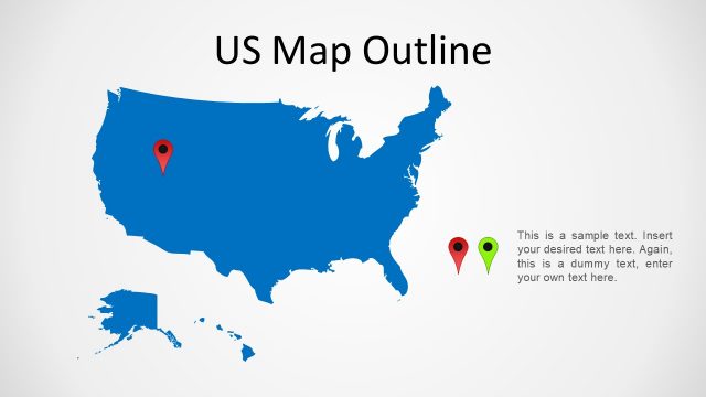
Slide 3 of 4 from US Map PowerPoint
United States 3D Map for PowerPoint
3D US Map with Markers for Presentations
- Map
- Country Map
- Context Slide
- 16:9
- 100% Editable
The 3D US Map with Markers slide from the US Map PowerPoint template offers a clear geographic visualization ideal for regional analysis and market coverage presentations. This slide layout includes editable shapes and location markers to highlight specific areas within the United States, making it a practical choice for business presentations or educational geography topics. Its design supports concise explanatory text alongside a three-dimensional map, enhancing the effectiveness of slide decks focused on location-based strategies.
About This Slide
United States 3D Map for PowerPoint is a slide containing an orange gradient 3D PowerPoint Map of the US. Ideal for geography lecture or trips routes location.
What’s on This Slide
The slide features a three-dimensional outline of the United States in orange, positioned centrally against a light gray background. Two location markers, one green and one red, are placed on the map, indicating specific locations. Text placeholders are situated above the map for the title and to the right for additional information, with a sample text indicating where to insert custom content. The overall layout emphasizes the map while providing space for explanatory text, creating a clear visual hierarchy.
How to Use It
This layout serves as a geographic representation, ideal for highlighting specific locations within the United States. It fits well in presentations discussing regional coverage, market analysis, or location-based strategies. The slide can be used to visually emphasize key areas of interest, making it suitable for business meetings, educational purposes, or marketing strategies that require geographical context. It is best positioned after introductory slides to provide detailed insights.
Text Placeholders & Capacity
Keep your copy within these limits so it fits without resizing. Body slots can hold around 15-20 words each.
| Placeholder | Count | Max characters (approx.) |
|---|---|---|
| Slide title | 1 | 20 |
| Body paragraph | 2 | 100 |
Slide Keywords
Download unlimited PowerPoint templates, charts and graphics for your presentations with our annual plan.
DOWNLOADReturn to US Map PowerPoint.