Slide 12 of 32 from #2 Editable Data Driven Maps Bundle
World Atlas PowerPoint Continent Maps
Continents Map Presentation Slide
- Text Layout
- Single Statement
- Section Divider Slide
- 16:9
- 100% Editable
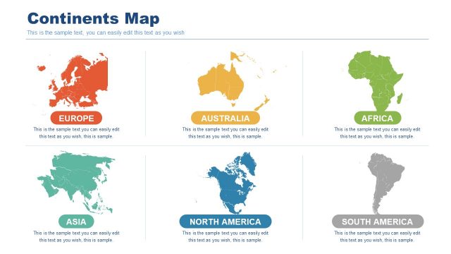
The Continents Map slide from the #2 Editable Data Driven Maps Bundle offers a clear section divider for geographic topics in business presentations or educational geography reports. This slide template features editable shapes and vector icons to enhance demographic or travel-related slide decks, making it a practical choice for professional PowerPoint templates and Google Slides templates focused on map-based data visualization.
What’s on This Slide
The layout features a large title at the bottom labeled 'CONTINENTS MAP' in bold, centered text. Above this, a circular icon with a map pin symbol is positioned centrally, indicating a geographic theme. The background consists of a detailed map with muted colors, enhancing the visual context. At the top, a triangular shape contains the section number '02' and the word 'Section.' Various small colored triangles are scattered around the top area, adding visual interest. Text placeholders are present for additional content, aligned centrally beneath the title and above the icon.
How to Use It
This layout serves as a section divider, ideal for transitioning between topics related to geographic data or analysis. It fits well in a presentation sequence that discusses different continents or regions, providing a clear visual cue for the audience. It can be used in business scenarios such as demographic presentations, travel reports, or educational contexts focusing on geography. The design allows for easy editing of text to suit specific content needs while maintaining a cohesive visual theme.
Text Placeholders & Capacity
Keep your copy within these limits so it fits without resizing. Body slots can hold roughly 30-40 words each.
| Placeholder | Count | Max characters (approx.) |
|---|---|---|
| Slide title | 1 | 30 |
| Body paragraph | 1 | 250 |
| Section number | 1 | 10 |
Slide Keywords
Download unlimited PowerPoint templates, charts and graphics for your presentations with our annual plan.
DOWNLOADReturn to #2 Editable Data Driven Maps Bundle.