Geographic Information System Value Chain

Light Color Flat Geospatial Analysis Value Chain for PowerPoint

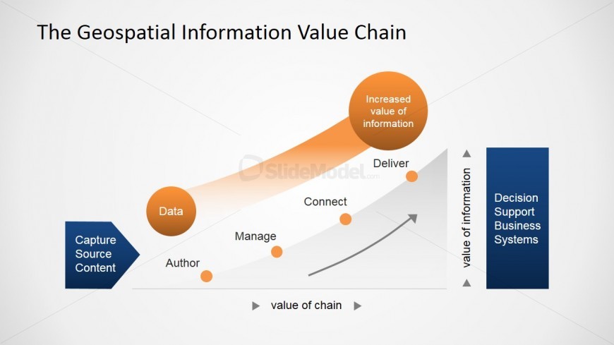
This slide features a composite image that describes a conventional value chain. Fully editable shapes created as PowerPoint clipart. This value chain denotes the increased value of information within the realm of geospatial industry. Here you can see six labelled circles (color and size can be changed) which depict key stages in the geospatial analysis, a single editable blue chevron and a single editable blue rectangle.

Return to Geospatial Information Value Chain PowerPoint Diagram.

Activate your subscription

Download unlimited PowerPoint templates, charts and graphics for your presentations with our annual plan.

DOWNLOAD

Slide Tags:

Author Business Capture Chain Connect Content Data Decision Deliver Information Manage Source Support System Value

Return to Geospatial Information Value Chain PowerPoint Diagram.

Download Unlimited Content

Our annual unlimited plan let you download unlimited content from SlideModel. Save hours of manual work and use awesome slide designs in your next presentation.

Subscribe Now