Slide 16 of 29 from Balkans Peninsula PowerPoint Maps
13022-02-balkans-peninsula-powerpoint-maps-16×9-16
Balkans Peninsula Map with Turkey
- Map
- Country Map
- Context Slide
- 16:9
- 100% Editable
What’s on This Slide
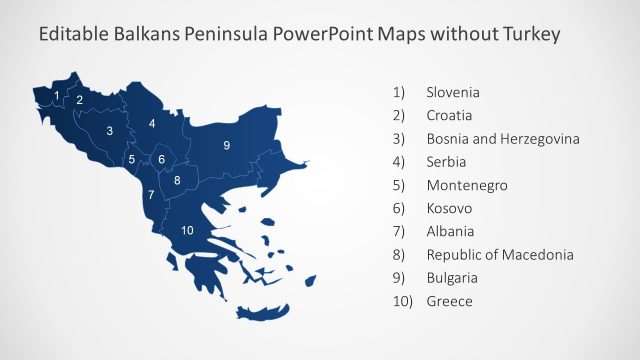
The slide features a map of the Balkans Peninsula, prominently displaying Turkey in a light blue shade. Surrounding countries, including Greece, Bulgaria, Serbia, and others, are shown in darker blue tones. Country names are positioned in a clear, legible font, with Slovenia and Kosovo at the top left and Albania at the bottom left. A text placeholder is located at the bottom right, indicating where additional information can be inserted. The overall layout emphasizes the geographical relationships among the countries in the region.
How to Use It
This layout serves as a geographical representation of the Balkans Peninsula, ideal for presentations discussing regional politics, demographics, or travel. It fits well in a sequence that introduces the Balkans or provides context for discussions on international relations. This slide is useful for businesses or organizations focusing on tourism, trade, or cultural exchanges in the Balkans region, allowing for visual engagement with the audience.
Text Placeholders & Capacity
Keep your copy within these limits so it fits without resizing. Node labels can hold about 3-4 words each, with the body slot being tight.
| Placeholder | Count | Max characters (approx.) |
|---|---|---|
| Item heading | 12 | 20 |
| Body paragraph | 1 | 50 |
Slide Keywords
Download unlimited PowerPoint templates, charts and graphics for your presentations with our annual plan.
DOWNLOADReturn to Balkans Peninsula PowerPoint Maps.