Slide 15 of 29 from Balkans Peninsula PowerPoint Maps
13022-02-balkans-peninsula-powerpoint-maps-16×9-15
Balkans Peninsula PowerPoint Map with Turkey
- Map
- Country Map
- Context Slide
- 16:9
- 100% Editable
What’s on This Slide
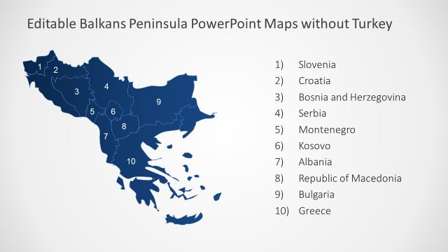
The slide features a map of the Balkans Peninsula, prominently displaying Turkey. The map is colored in dark blue, with numbered regions indicating various countries. The numbers are positioned within the respective regions, with a clear visual hierarchy. The title is located at the top, while a list of countries is aligned to the right side, numbered from 1 to 11. Text placeholders exist for the title and country names, with the title being larger and bold. The background is light gray, enhancing the map's visibility.
How to Use It
This layout serves as a geographical representation of the Balkans Peninsula, suitable for discussions on regional politics or demographics. It fits well in a presentation sequence following an introduction to the region or a problem statement. This slide is useful for educational contexts, business presentations, or strategic planning sessions focused on the Balkans. It can effectively illustrate relationships between countries or highlight specific geopolitical issues.
Text Placeholders & Capacity
Keep your copy within these limits so it fits without resizing. Node labels can accommodate around 30 characters each.
| Placeholder | Count | Max characters (approx.) |
|---|---|---|
| Slide title | 1 | 40 |
| Item heading | 11 | 30 |
Slide Keywords
Download unlimited PowerPoint templates, charts and graphics for your presentations with our annual plan.
DOWNLOADReturn to Balkans Peninsula PowerPoint Maps.